Annamaria Luongo
Data visualisation

Multiple ways to visualise Copernicus data.

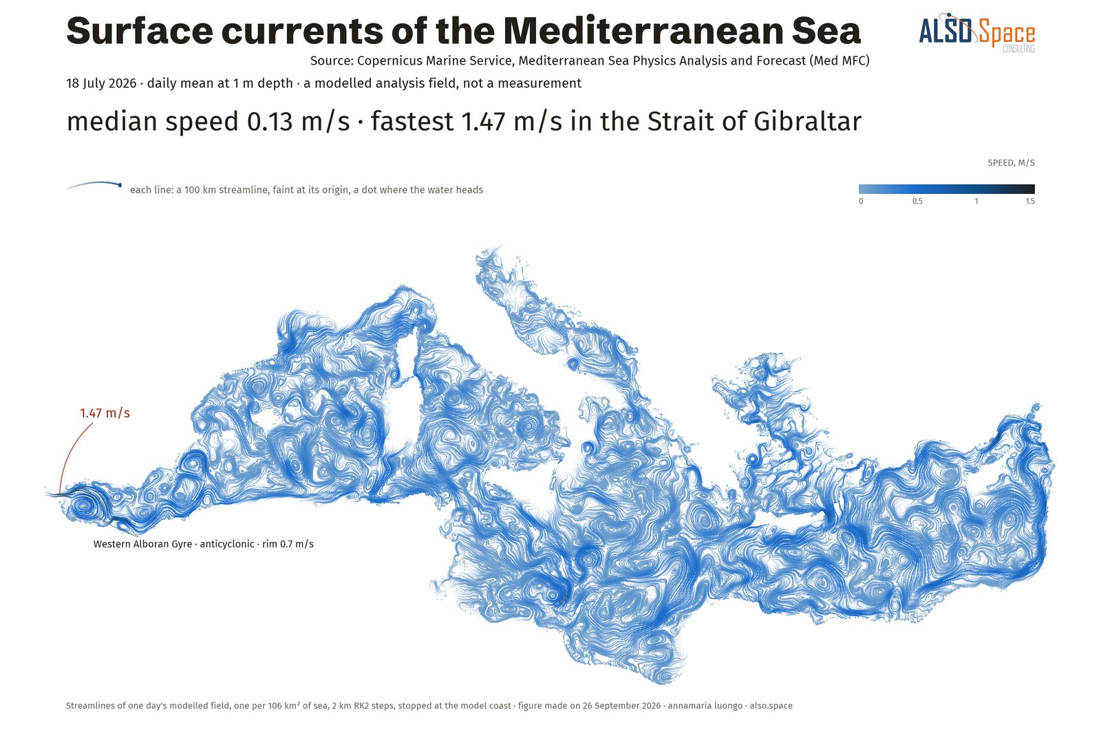
Two pieces on the home page move with the scroll, and the rings are updated every day from the C3S Climate Pulse. A scrollytelling story shows the Mediterranean Sea in summer 2026, and each of the fourteen figures below applies one visual mechanism to Copernicus data.

Summer 2026, how far from normal, country by country.Thirty countries over three months, with the bars re-sorting as the month changes. ERA5 at 0.25° and, for Malta, ERA5-Land at 0.1°; my calculation, computed on 13 September 2026.On the home page →Thirty-six years of daily global temperature, one ring per year.C3S Climate Pulse, ERA5, updated every day: data to 26 September 2026.Live on the home page →The Mediterranean Sea in summer 2026.Scrollytelling: surface currents on 18 July and the daily temperature anomaly of the sea, from the Copernicus Marine Service.Read the story →
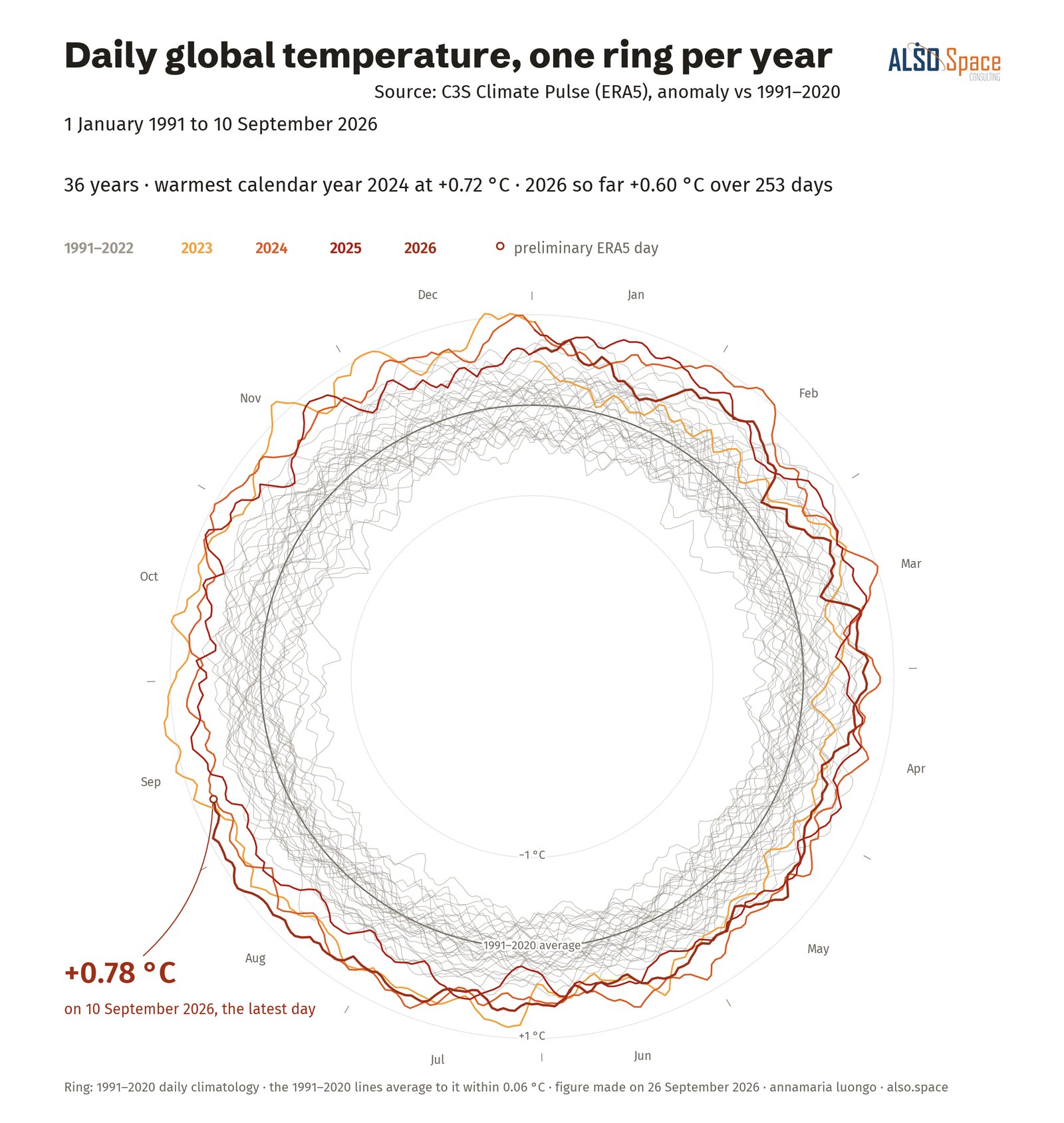
Daily global temperature, one ring per year
Daily global temperature, one ring per yearcycle clock · C3S Climate Pulse, 1991–2026
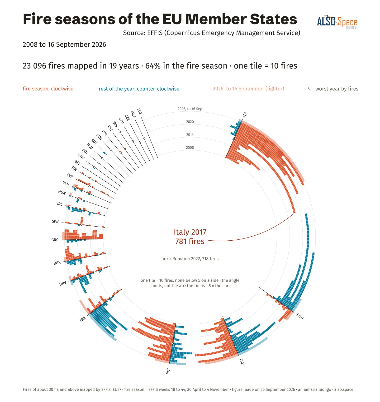
Fire seasons of the EU Member States
Fire seasons of the EU Member Statestime rings · EFFIS, weekly fires 2008–2026
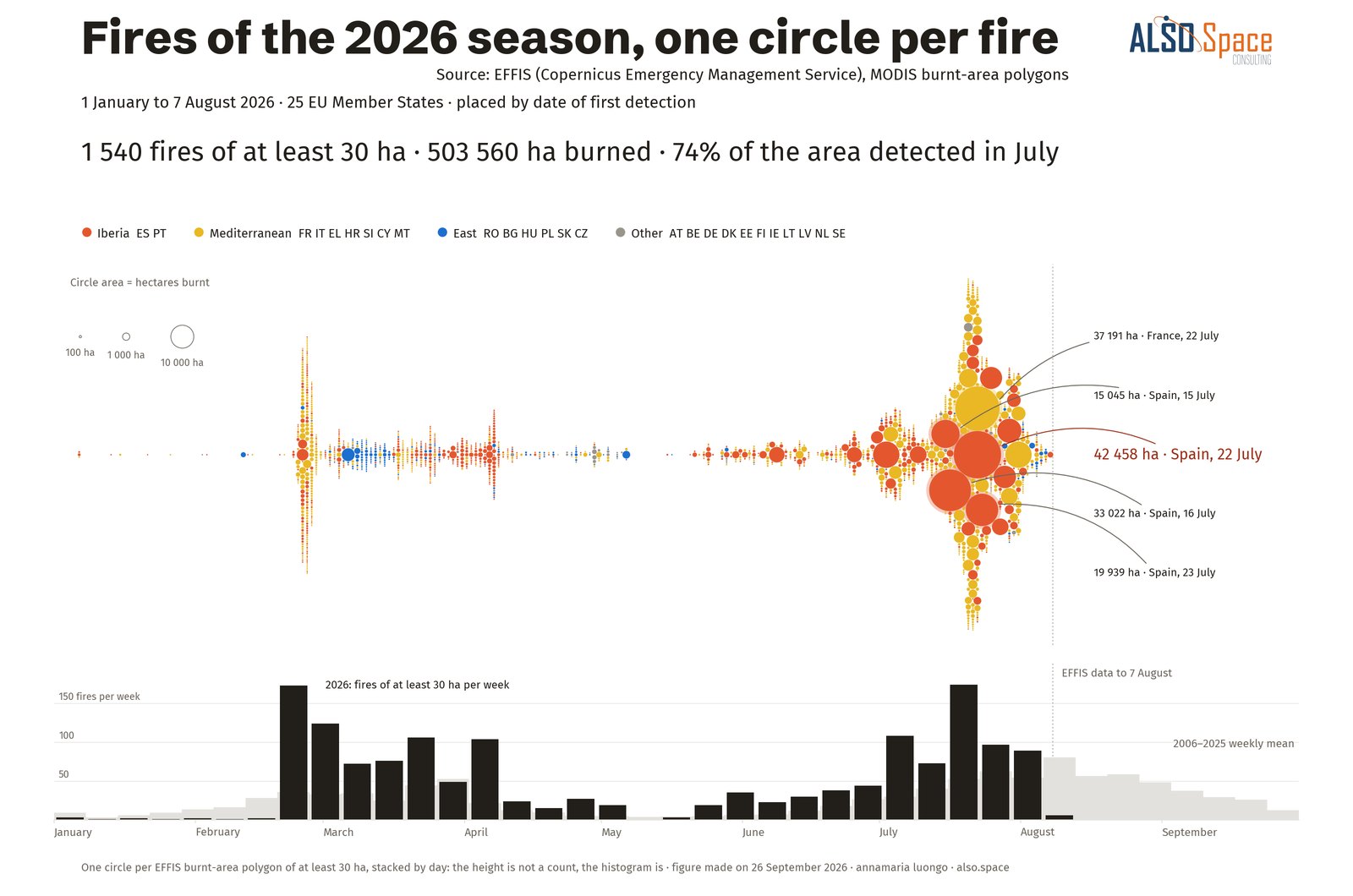
Fires of the 2026 season, one circle per fire
Fires of the 2026 season, one circle per fireunit swarm · EFFIS, 1 January to 7 August 2026, 1,540 fires of at least 30 ha
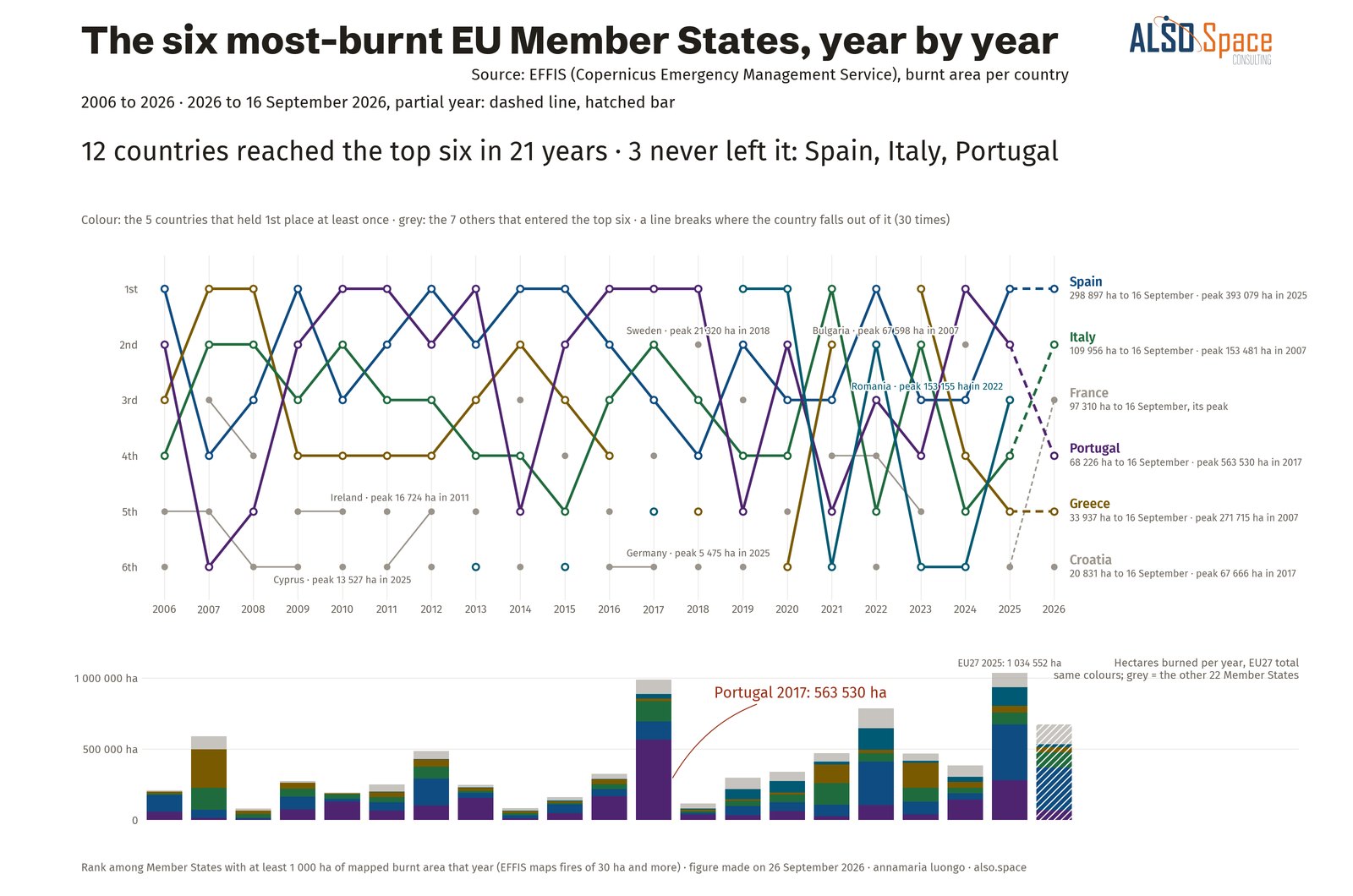
The six most-burnt EU Member States, year by year
The six most-burnt EU Member States, year by yearentity ribbons · EFFIS by country, 2006–2026
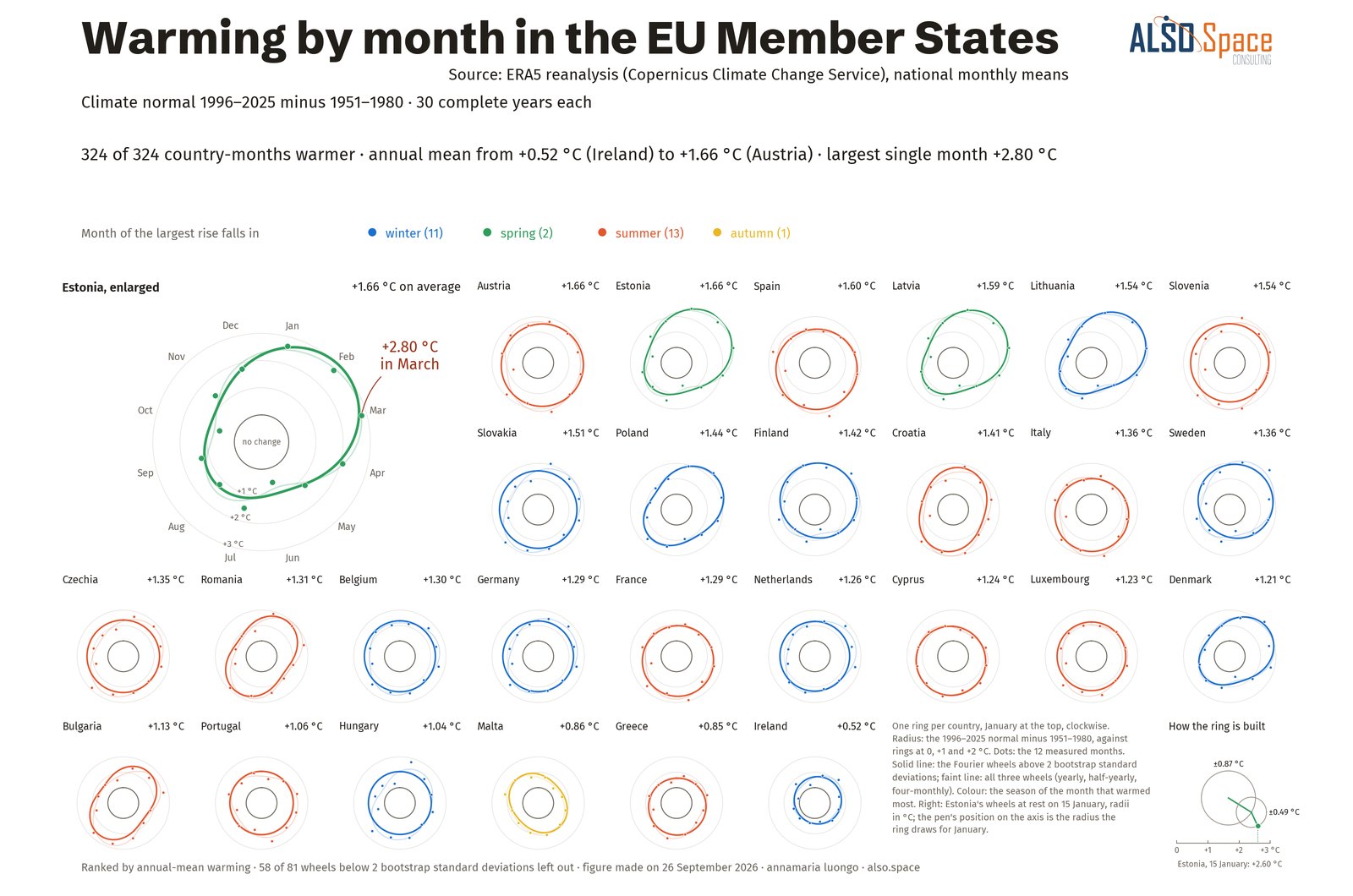
Warming by month in the EU Member States
Warming by month in the EU Member Statesharmonic curves · ERA5 by country, two climate normals
Surface currents of the Mediterranean Sea
Surface currents of the Mediterranean Seafield trajectories · Copernicus Marine, 18 July 2026
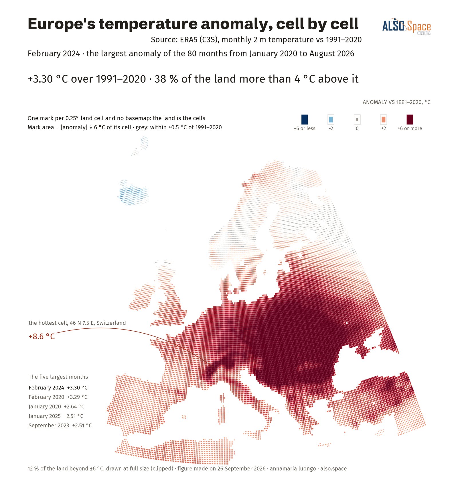
Europe's temperature anomaly, cell by cell
Europe's temperature anomaly, cell by cellfield to cells · ERA5 at 0.25°, February 2024
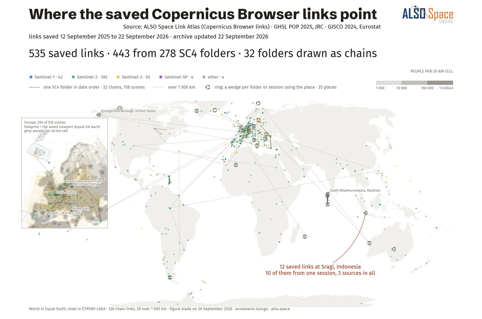
Where the saved Copernicus Browser links point
Where the saved Copernicus Browser links pointrecord point maps · Link Atlas, 535 saved links to 26 September 2026
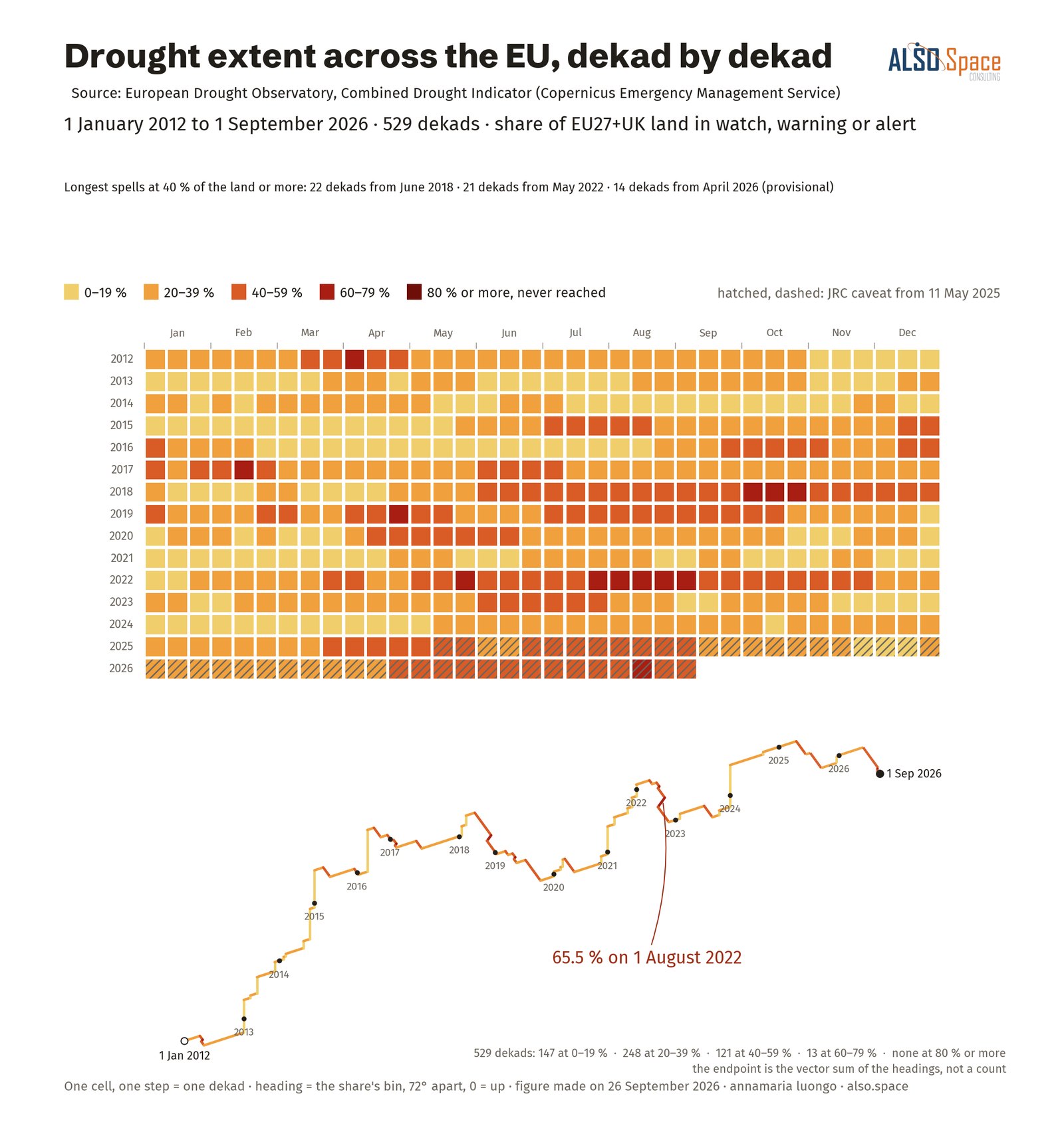
Drought extent across the EU and the United Kingdom, dekad by dekad
Drought extent across the EU and the United Kingdom, dekad by dekadsequence paths · EDO Combined Drought Indicator, 2012–2026
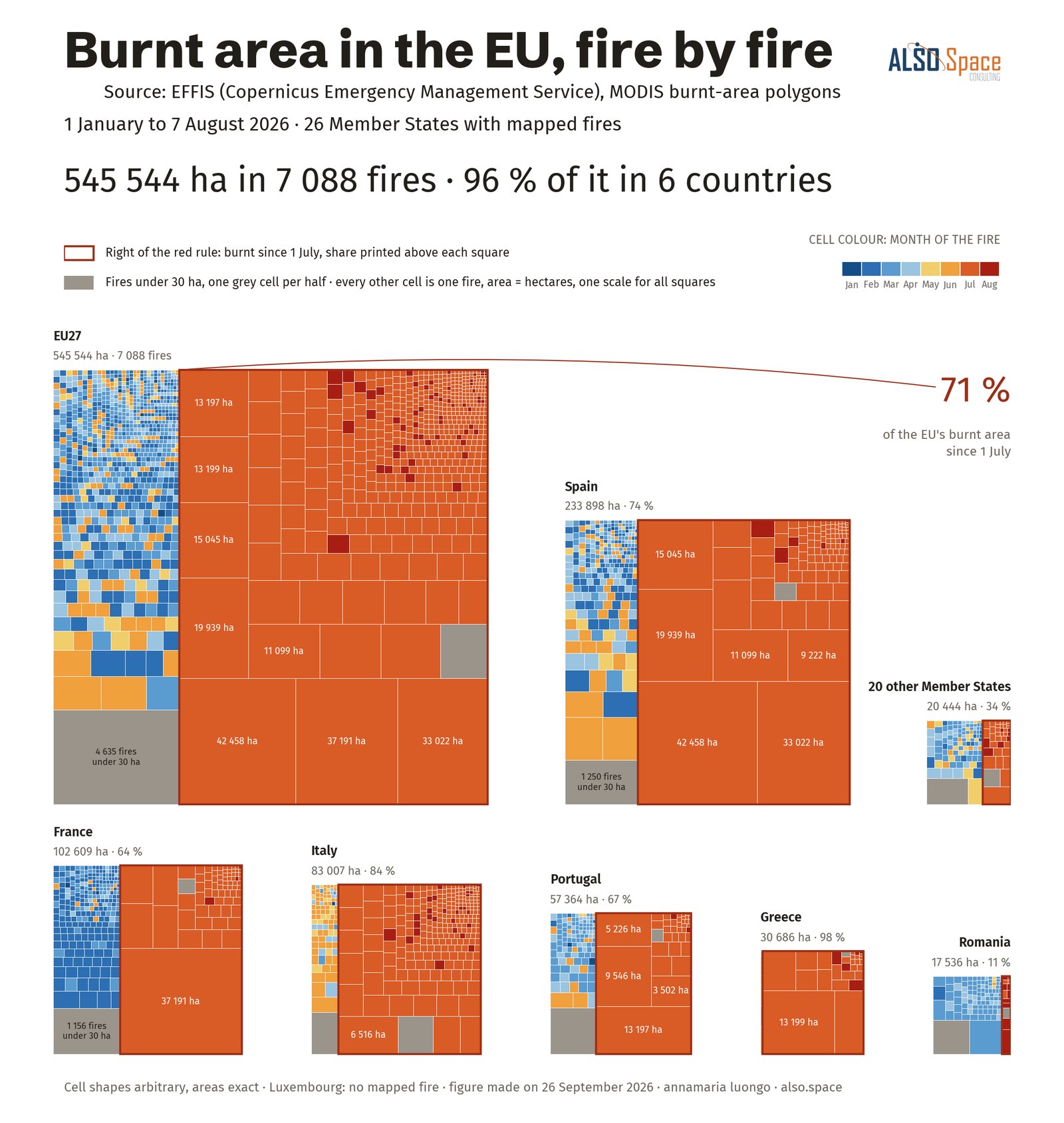
Burnt area in the EU, fire by fire
Burnt area in the EU, fire by firepart of whole · EFFIS, 1 January to 7 August 2026, 7,088 polygons
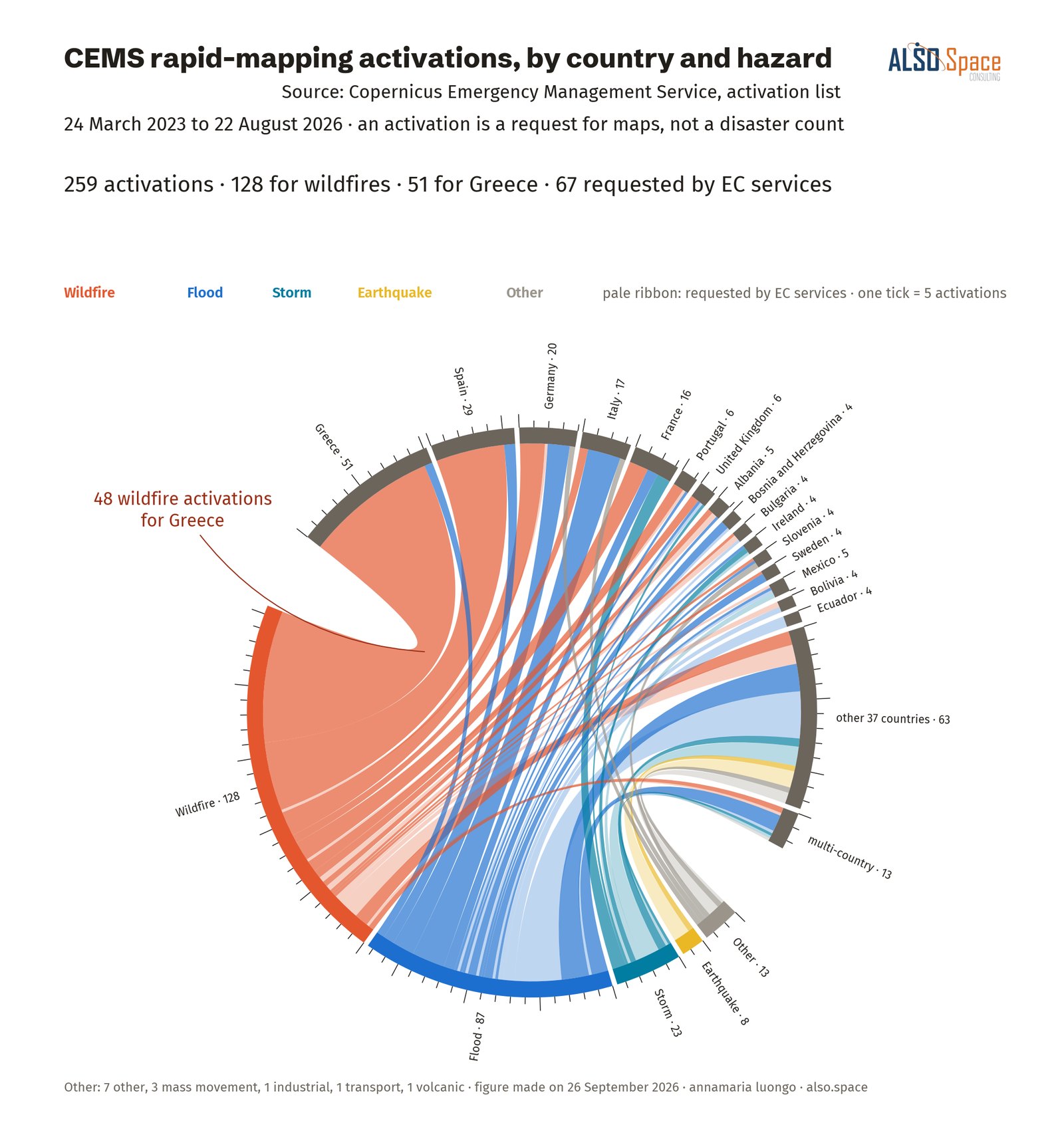
CEMS rapid-mapping activations, by country and hazard
CEMS rapid-mapping activations, by country and hazardmatrix flows · Copernicus Emergency Management Service, 2023–2026
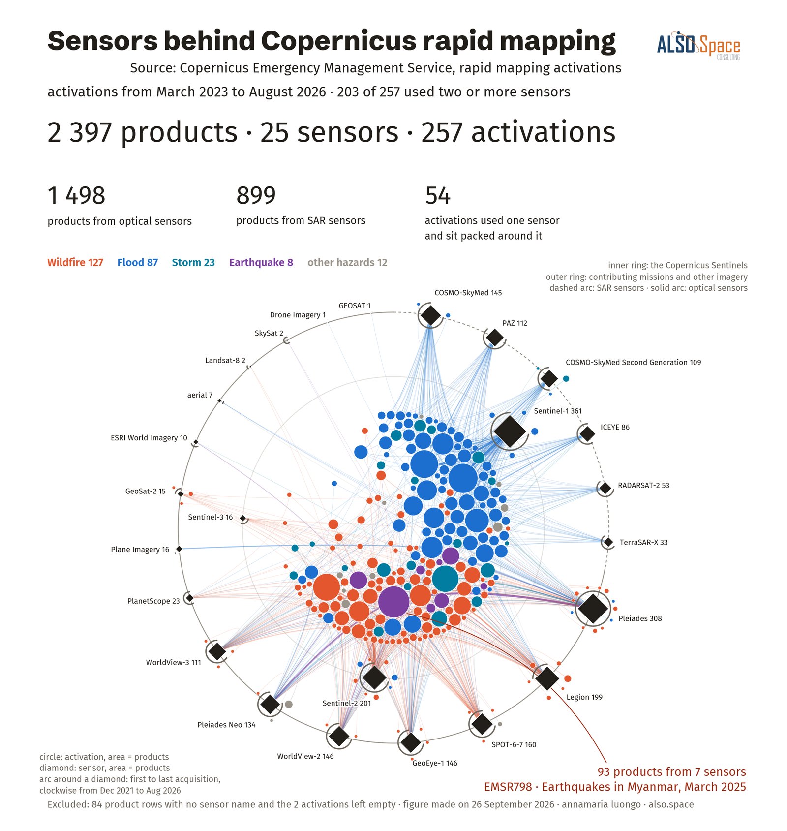
Sensors behind Copernicus rapid mapping
Sensors behind Copernicus rapid mappingstructure networks · 2,397 CEMS products, 25 sensors
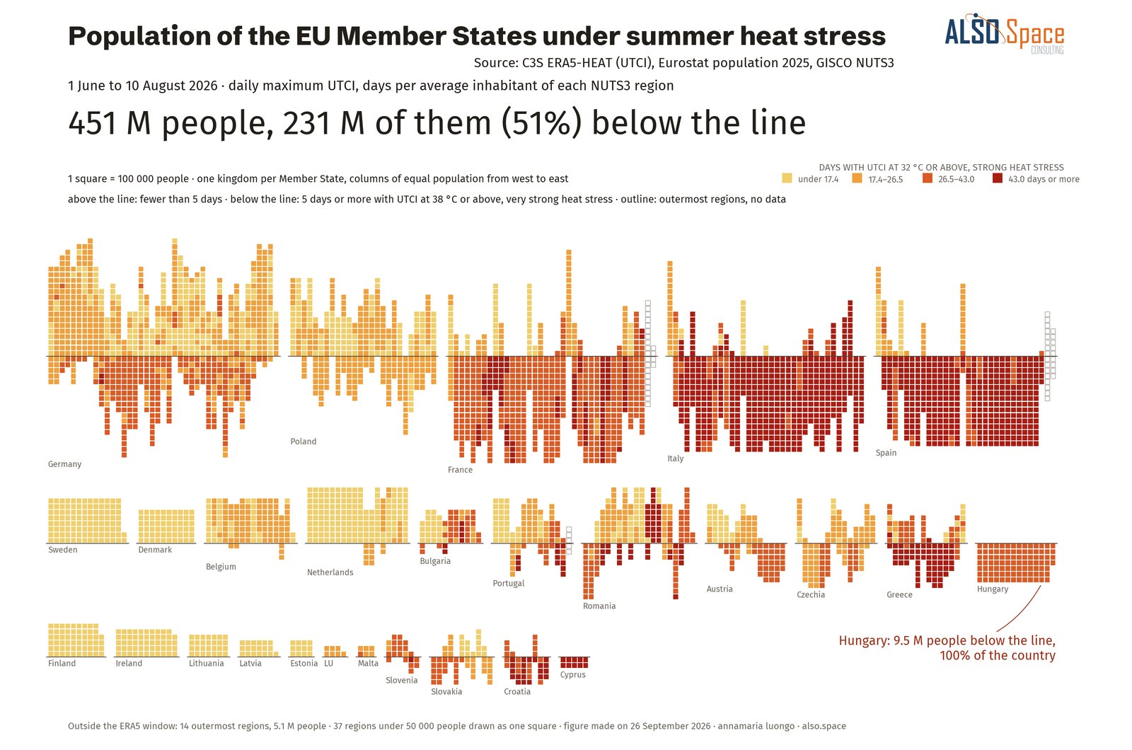
Population of the EU Member States under summer heat stress
Population of the EU Member States under summer heat stressunit grids · ERA5-HEAT and Eurostat population, 1 June to 10 August 2026
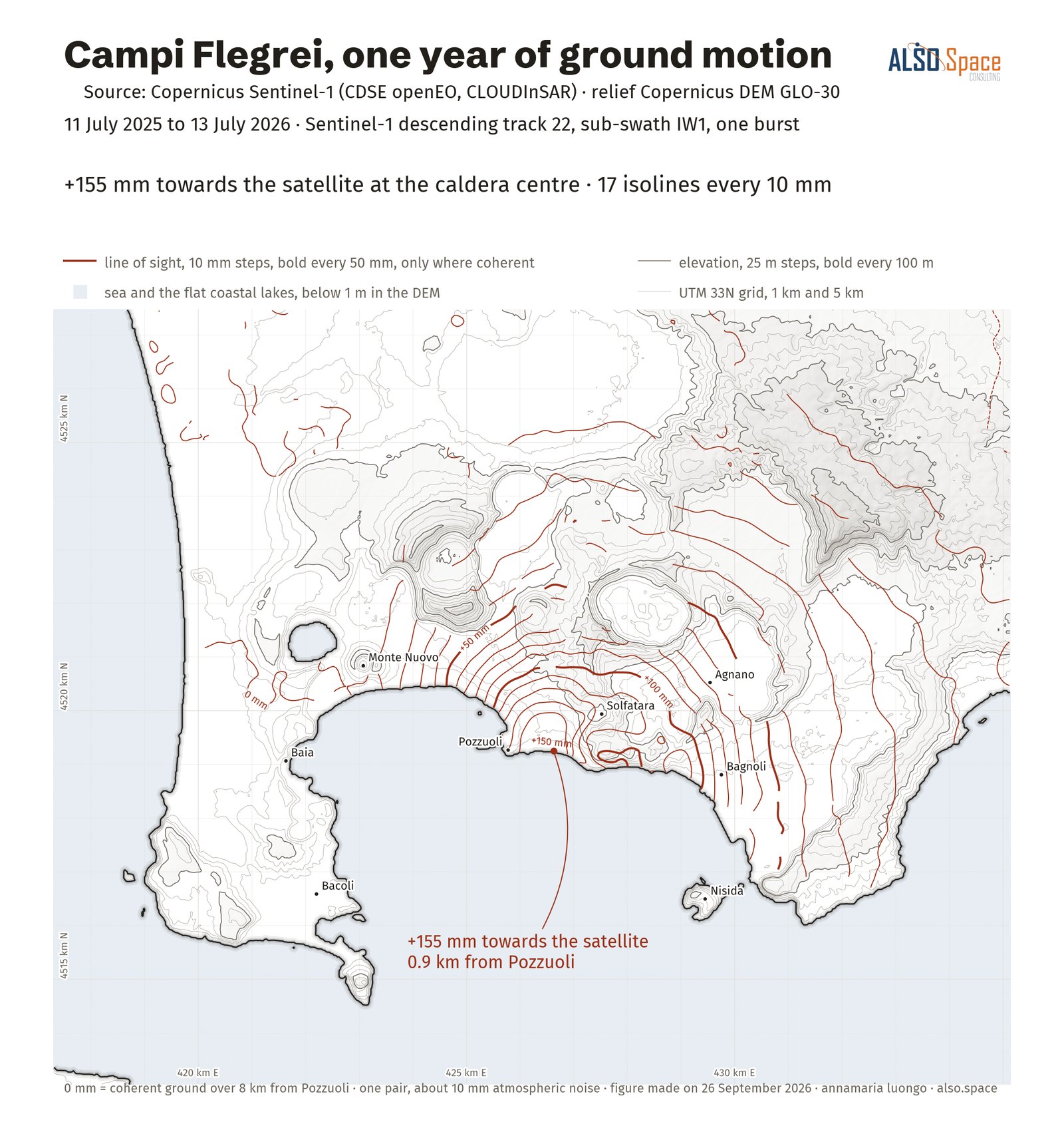
Campi Flegrei, one year of ground motion
Campi Flegrei, one year of ground motionreference cartography · Sentinel-1 InSAR and Copernicus DEM